
Advertiser not validated.

listing placed 09 May 2021 United Kingdom
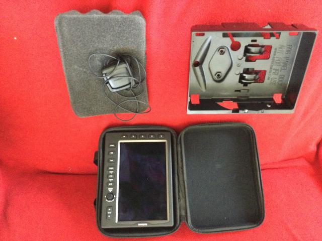
Garmin 695 NOW SOLD Thank you Afors
Click on the images above ↑ to see the new full image viewer. ↑
695 Now Sold
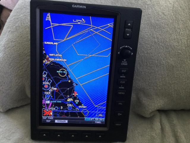
GPSMAP 695 is Garmin’s ultimate portable MFD. Similar to the 696, the GPSMAP 695 comes with a large screen and detailed electronic charts
The GPSMAP 695’s bright 7" diagonal high-definition SUNLIGHT READABLE display makes detailed mapping easy to see day or night — View an entire approach plate on the large-format display. For easy operation, the bezel around the screen includes soft keys and a joystick control. And the internal GPS provides position updates five times per second (5 Hz), allowing the 695 to present flight data smoothly and continuously.
No Chart? No Problem.
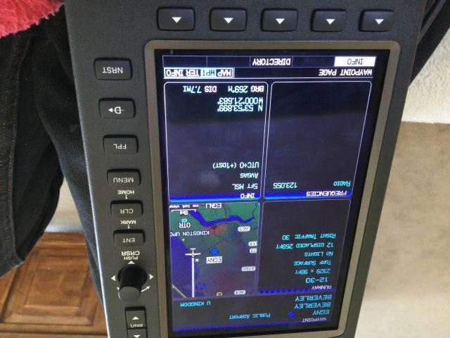
With the addition of IFR map mode, Garmin FliteCharts® and ChartView™, the GPSMAP 695 provides key functions of a Class 1/Class 2 electronic flight bag (EFB), reducing the use of paper charts in the cockpit. When in IFR map mode, the 695 can display victor airways, jet routes, minimum enroute altitudes and leg distance, much like what’s found on traditional enroute charts. With geo-referenced FliteCharts, you can quickly find and view all U.S. AeroNav Services, standard terminal arrival routes (STARs), approach charts and airport diagrams. For pilots who prefer Jeppesen charts and diagrams, Garmin also offers ChartView. The ChartView service utilizes Jeppesen’s extensive library to provide global geo-referenced charting capabilities (Chartview activation instructions).
Enhance Situational Awareness
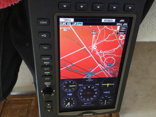
The GPSMAP 695 features a high-resolution terrain page showing hazards relative to your altitude and a vertical profile of terrain along your route of flight. It comes with a built-in Jeppesen database, and an Americas, Atlantic or Pacific terrain database. It also includes an obstacles database for the U.S., Canada or Europe. Using this information, the 695 displays your flight route over contour terrain mapping. With information from the terrain and obstacles databases, the 695 monitors your current position in relation to surrounding terrain to provide alerts. To help keep pilots aware of special airspace activity, over 683 parachute drop zones are detailed in the Americas navigation database. You can even customize your own minimum clearance levels to receive terrain cautions. The 695 also comes with a realistic “view from space” satellite imagery basemap.
